NEWSThe GIS Section of IT Department has made another landmark achievement by developing an in-house web based GIS application for Karachi Region on ESRI ArcGIS (Microsoft Silverlight API/Platform Version 5).
This landmark achievement replaced the existing ArcGIS Web ADF base GIS application with ArcGIS for MS Silverlight API/Platform.
Recently, ESRI announced that ArcGIS Version 10.1 for Server is the last release with support for the ArcGIS Web Application Developer Framework (ADF) for .NET and Java.
Other salient features of new web base GIS Application for Karachi Region are;
- Users can browse GIS application with relatively high speed if compared to existing GIS application.
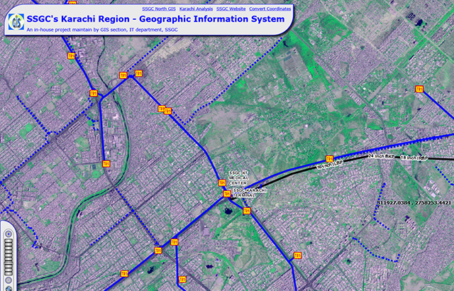
- Users can change existing Vector Basemap with latest quick bird high resolution (0.6m) and natural color composite satellite data and spot high resolution high resolution (2.5m) and panchromatic satellite data.
- Users can get summarized results of pipeline length in a desired drawing area (draw with the help of “Draw Polygon Tool”) with Region, Billing Zone, Gas Distribution Pipeline Type, Diameter and Gas Pipeline Material.
- Users can get/measure Area, Length and Coordinate (Longitude, Latitude) of an object using Draw Shapes to Measure Tool (using Point, Line, Freehand Line, Rectangle, Circle, Ellipse, Polygon and Freehand Polygon).
- Users can go to specific object by entering its coordinates in decimal degrees (Longitude, Latitude).
- Users can view attribute table of all vector layers from map contents.
- Users can draw point, line and polygon graphics as redline on the screen.
- Users can print maps in all popular formats on A4 and A3 size pages (landscape) with all necessary details.